Drone Surveying improving productivity, Planning and Management of Mine Sites

Search

Over recent years, we have witnessed drone technology advancements push aside the traditional methods of mine monitoring and surveying.

Drones have become increasingly popular in support of mining applications with exploration, surveying and mapping. Australia and Africa have led the way in adoption of unmanned aerial vehicles (UAVs) across their mining industries to maintain safety, increase oversight and enhance security. 

Drone Mining Survey

UAVs (unmanned aerial vehicles) have been increasing in popularity in the mining industry for the last 10 years. As the technology has improved in leaps and bounds, so too has the number of drones deployed on mine sites for a variety of applications.

Drones using cameras, LIDAR technology, or plugged into photogrammetry software, can create full 3D and 4D images and maps of wide expanses of land, contour lines, digital terrain models or digital surface models. The mine survey images generated by a drone camera or LIDAR technology provide detailed information to assist mining operators with managing, planning and optimisating production on the mine site.

Uses of Drones in Mining

Most large mine sites in Australia in 2020 now have a couple of roustabout drones on site and a couple of trained, licensed pilots to deploy the drones at short notice to critical equipment, mapping or production challenges onsite.

The most popular uses of drones in mining applications include:
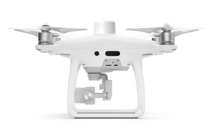
DJI Phantom 4 RTK Drone Australia | drones for mining
  • Stockpile management: The volume and placement of stockpiles can be accurately predicted with mine aerial surveying. This information helps you produce better inventory and financial data along with improved data for weekly or monthly management.
  • Monitoring and operation planning: Drone imagery can accurately estimate any volume of material needing to be removed from a mine site in compliance with plans or legal standards, such as creating water and sediment flow, or monitoring tailings dam levels remotely (see below).
  • Automatic surveying and mapping: Surveying and mapping of mineral landscapes becomes a quicker process with the use of a drone.
  • Haulage road optimisation:  The efficiency of mining applications is dependent on the haulage road networks. The road conditions must be regularly monitored for safety.
  • Assessment before and after drilling or blasting: Drones in mining produce cost-effective and accessible 3D reconstructions along with surface models to display the drilling or blasting site area.
  • Hazard identification and mitigation: Safety is a priority on any mine site, and drone surveying can easily identify any safety hazards with high-resolution images.
  • Tailings dam management: Managers of tailings dams use drone surveys for measurements, which eliminates the risk of manual surveying.
  • Mining exploration: Mining exploration is supported with the use of drone survey imagery, particularly in site areas that are difficult to navigate by foot.

Drone Mining Survey Maps 

Photogrammetry is the process of overlapping a series of images containing geospatial information to create a survey map – which come in the 4 forms expressed below. Every pixel of each drone image contains its own georeferenced location in space, using RTK or PPK technology – and these maps can get within +-2-5cm absolute accuracy (provided the drone is flown at 100m above ground). This type of mapping and surveying is done extensively during mining exploration and mine project planning, as many calculations, research and data goes into estimating the operations and earthworks required to access the mineral deposit and ultimately get the mine into production. 

The most common mine survey maps include:
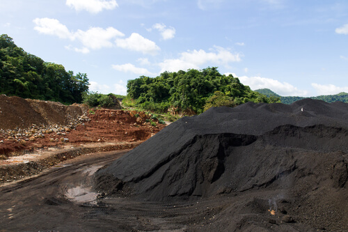
  • Orthomosaic maps – made from hundreds or thousands of images of the mine area, and creates an accurate picture of the mine site’s topography
  • 3D point cloud – helps surveyors plan and design the earthworks required to level the ground, or dig an open pit to commence mining operations
Drones for mining Aptella
  • Digital terrain model (DTM) – can express the real topographic shape of the ground below for use in survey planning
  • 3D textured mesh – assists in the mathematical calculations required to estimate how many metric tonnes of earth need to be removed or moved for mining to commence on a site

Main Benefits of Drones in Mining

Below are the three main reasons drones have become so popular in mining operations in Australia:

  1. Drone mining surveys are known to produce highly accurate measurements using photogrammetric cameras and software – which is highly useful in mining stockpile management, usually a daily problem for mine managers. For example, our drones create thousands of data points for one stockpile. When you combine these data points using software, you can identify all the surface unevenness and undulation to prevent any safety issues with stockpile subsidence. These surveys are therefore essential to minimise errors in stockpile volume calculations and the data obtained by drones can even contribute to accurate production calculations.
  2. Using a survey drone to capture data, or images from the field, is 30 times quicker and easier than using traditional surveying or inspection methods on a site. Provided the drone is sub 2kg, any site employee can easily collect your mine site survey or inspection data if they’re trained to fly a drone. You then have the freedom to survey or inspect remote areas of your mine site at any frequency that best suits.
  3. Drone surveys provide comprehensive imagery that identifies any safety hazards to help you improve worker and mine site safety management, compared to traditional surveying equipment. All danger zones and hazards can be eliminated that would otherwise be unsafe for employees navigating and exploring through the mine site. This is all possible without disrupting your company workflows and movement of machines.
  4. Real-time, moment-to-moment progress monitoring is possible with mining drones – you can work remotely and obtain real-time images from above your site and track the progress of a construction design, or a mine’s production without leaving the site. Capturing regular images every day can also paint a picture of progress over time and can be used to communicate to remote offices or project stakeholders that aren’t on the site every day.

Survey-Grade Drones for the Mining Industry

Aptella offer a range of surveying drones for sale that are ideal in the mining industry. We provide survey-grade drones from leading suppliers involving Intel, DJI, Quantum Systems and more that are safe and accurate for industrial applications. The DJI Phantom 4 RTK is ideal for the majority of mine surveys, with the exception of the mine site size.

Leave a Reply

Your email address will not be published. Required fields are marked *